
| |
| Volume 6, Number 5 | September/October 2000 |
Last issue I explained how we know, from available Biblical, archaeological, topographical, and chronological evidences, that Mt. Yeroham in Israel is the Biblical Mt. Sinai.
After reading the last issue a friend wrote me asking about Galatians 4:25, which I had not discussed. This verse mentions (NASB), "Mount Sinai in Arabia…". It raises the question: "But is Mt. Yeroham in Arabia?"
I dealt with this question several years ago, but forgot to review it last issue. Here is the kernel of the answer from my previous discussion.[1]
Arabia, in New Testament times, included the Sinai Peninsula (where the traditional site of Mount Sinai is located) and the Negev of Israel (where I have suggested Mount Sinai is really located). (You can easily verify this using a Bible atlas or maps of the Mediterranean regions at the time of Paul found in many Bibles.)
This issue I move from a discussion of how we know Mt. Yeroham is the Biblical Mt. Sinai to a report on my recent excursion to Mt. Yeroham. My purpose in going to Mt. Yeroham was mainly to document the state of the site today, as I explained last issue. My purpose with the present article is to put what was found at Yeroham on public record.
Philip (my cameraman) and I were scheduled to fly from Chicago to Tel Aviv on Tuesday, June 13. Unfortunately, a series of thunderstorms grounded air traffic, which caused our flight to be canceled.
Rescheduling turned out to be more difficult than usual. Many tourists were going to Israel to celebrate year 2000. There were almost no spare seats on airplanes headed for Israel.
We ended up flying out of Chicago two days later, on June 15, on a flight to Amsterdam. After a lengthy stopover in Amsterdam we arrived in Tel Aviv in the early morning hours of Saturday, June 17.
We rented a car at the airport and headed south toward Be'er Sheva in the dark, and then on toward Yeroham. We only got lost once in Tel Aviv, and once in Be'er Sheva on the way.
We watched the sun rise above the eastern horizon, and the full moon sink below the western horizon as we neared the end of our journey, well to the south, in the parched Negev hill country.
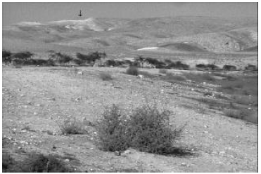
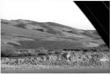
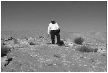
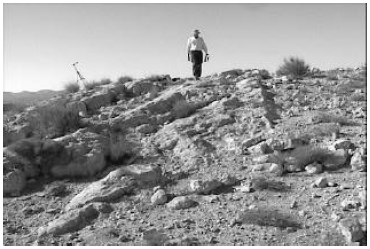
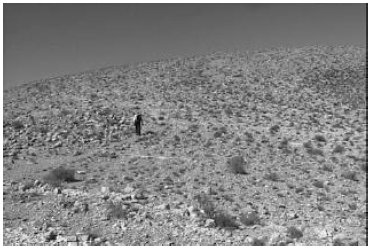
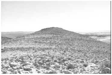
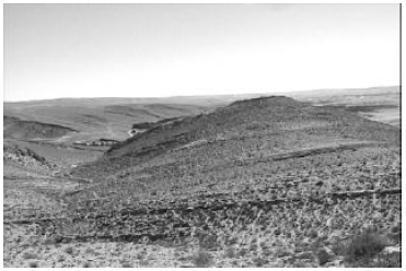
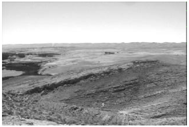
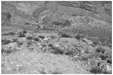
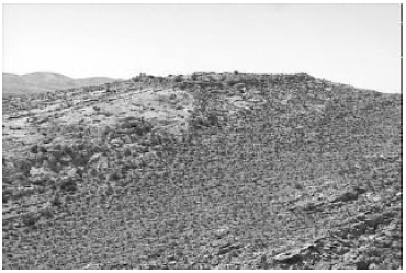
Shortly after 6:00 a.m. we were viewing the true Mt. Sinai from the road for the first time. Yeroham is a low, sprawling mountain—hardly the sort of thing to titillate one's spiritual vanity. The glory of Sinai rests in what God did there four and a half thousand years ago, not in any intrinsic physical grandeur.
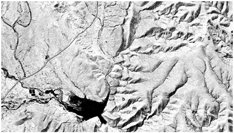
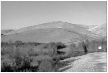
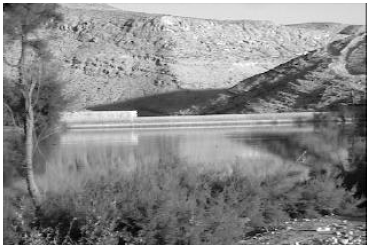
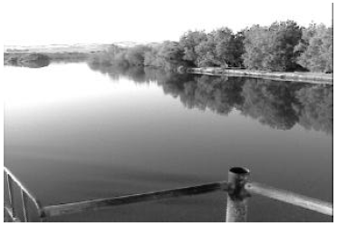
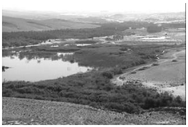
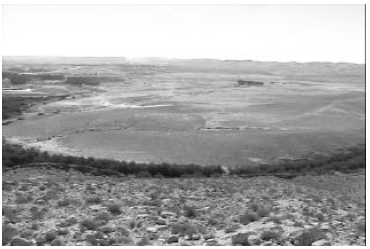
Our initial objective was to drive around the mountain, sticking to the main roads, to survey the area from all angles and find the best place to park our car for hiking up into the mountain. We were surprised to find an extensive, abandoned national park, incorporating the reservoir we had seen previously in satellite photos of the area (Figure 1), to the east of the mountain on the edge of the town of Yeroham.
 |
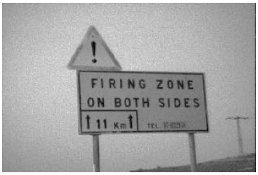 |
Also unanticipated were signs on either side of the road, as soon as we had gone a few kilometers from the town of Yeroham, which read "FIRING ZONE ON BOTH SIDES". We soon realized that the whole area of which Mt. Sinai is a part is presently being used as a military training grounds. We began to be glad that we had arrived on a Sabbath, when everyone—military included—was taking the day off, allowing us to explore without incident or interruption.
 |
 |
 |
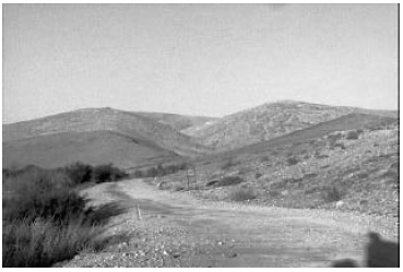
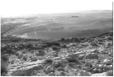
The best view of the mountain, we soon discovered, is from the east, where the Israelites camped. We found the best place to park was in the parking lot of the abandoned park. It would have saved us several miles of hiking to use the roads of the park to drive closer to the mountain. But these roads were all blocked off, and a policeman who drove into the area while we were there said—in very halting English—that it was okay for us to hike into the park, but we should not take our vehicle any further than the parking lot.
We explored the park on foot that morning, just finding our way around. The sky was completely clear, and the early morning temperature was pleasant.
By 8:00 a.m. it was already beginning to get hot. We drove on to Ben Gurion University of the Negev where we would be lodging. We intended to do some planning in our room that afternoon, for our major assault on the bamah early the next day, but we wound up falling asleep from sheer exhaustion instead.
 |
 |
We woke in the early evening, and drove to Dimona to get something to eat. We were good and hungry; we calculated that we hadn't eaten anything in nearly twenty-four hours by that point.
Sunday morning, June 18, was very productive. Our goal for the day was to ascend to the bamah—where Moses had erected an altar four and a half thousand years previously at the foot of Mount Sinai (Exodus 24:4)—and spend time there making observations, recording measurements, and taking photos.
 |
 |
We rose at 5:00 a.m. and had a light breakfast of granola bars and dried fruits. We left our rented room around 5:30 a.m. and arrived at Yeroham near 6:00.
We left our car in the parking area at the entrance to the park and, equipped with knapsacks and several quarts of water each, began the hike through the park, around behind the dam, and up the steep hill to the bamah.
By 6:30, with frequent stops to photograph what we were seeing, we had arrived at the front of the dam.
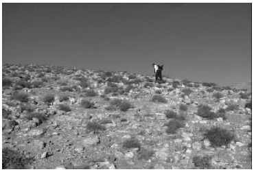
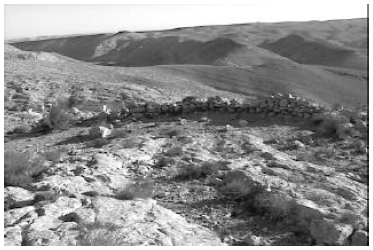
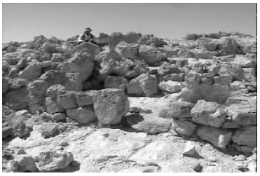
Another forty-five minutes, after a strenuous climb up the steep side of the bamah hill, found us just outside the bamah wall, near the crest of the hill.
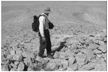
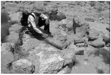
I had anticipated this moment for months. I climbed over the wall knowing that I was the first person in many, many centuries to set knowledgeable eyes on the interior of this holy place.
 |
 |
 |
 |
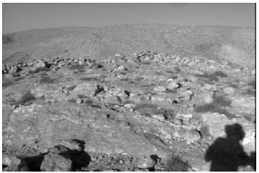 |
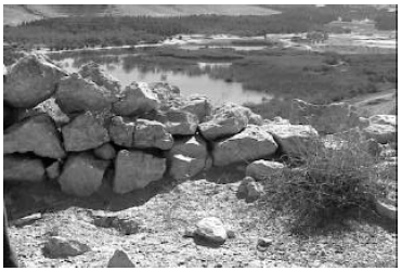
The site had obviously suffered some considerable depredation over the four and a half thousand years it had stood exposed here. Substantial remnants of the stone wall surrounding the quarter-acre site still survived all around the perimeter. But no recognizable vestige of the original altar remained. Numerous large stones were scattered about within the bamah and also outside the walls. Many of these were doubtless part of the walls or the altar Moses had built there originally.
 |
 |
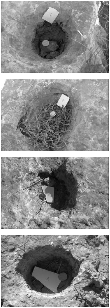
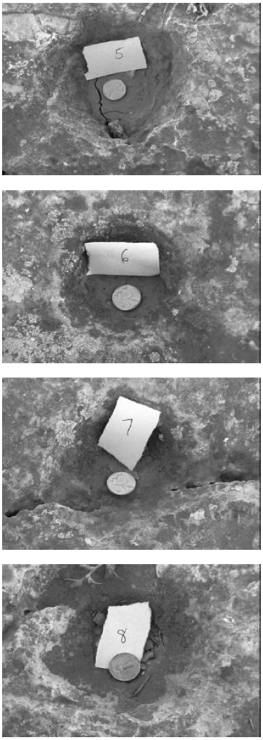
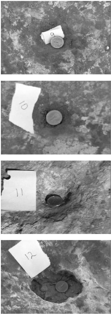
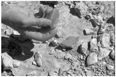
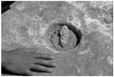
One of our major objectives in visiting the bamah was to document the layout and size of the twelve cupmarks the archaeologist Moshe Kochavi said were located there.[2] In this regard we were surprised and disappointed. We had expected to find twelve distinct cupmarks of roughly the same size arranged in a neat line or some other obvious pattern. In fact, we were only able to count twelve "cupmarks" by including everything which might possibly have been a cupmark, and those we did identify were not in a neat line or other pattern.
 |
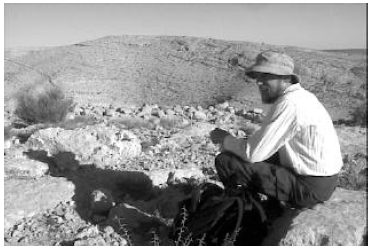
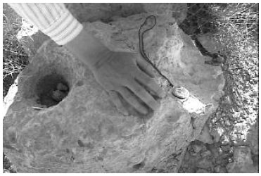
The twelve "cupmarks" we found were depressions in the limestone surface near the center of the bamah, near where the alter must originally have been situated. We numbered them from most to least distinct. (See Figures 18–20. Note that the coin, for scale, is one shekel in all cases; it is slightly smaller than a U.S. one cent coin, roughly 18 millimeters in diameter.) The first six were unambiguously cupmarks. The remaining six were depressions in the limestone surface of varying degrees of shallowness, some of which may have been due to natural causes.
 |
 |
 |
These twelve "cupmarks" were found to be scattered around a line running roughly north and south. Thus they faced the plain where the Israelites' tent city had been situated.
The line around which the cupmarks were scattered was found to be several feet to the east of the north-south centerline of the bamah (i.e., displaced from center toward the plain by several feet). Cupmark #1 was the furthest to the south. It was forty feet from the stone wall on the south side of the bamah. Cupmark #3 was the furthest to the north. It was forty-three feet from the north wall, and almost fourteen feet from cupmark #1. Summarizing these observations we may say that the cupmarks were found to be roughly centered in the bamah, though slightly displaced toward the plain.
The idea that the original purpose of these cupmarks was to serve as the basins mentioned in Exodus 24:5–6, to receive half of the sacrificial blood, seems strengthened by this observed placement. But as this placement is dependant upon the proper identification of the cupmarks in each individual instance, and as proper identification of all cupmarks seems quite uncertain at this late date, as mentioned above, no guaranteed conclusion regarding their origin or purpose seems possible at present.
One thing which does seem certain is that we are not viewing these cupmarks as they would have appeared four and a half thousand years ago. The cupmarks are cut into a very soft limestone. Because rainwater is acidic it erodes limestone by slowly dissolving it. The bottoms of several of the cupmarks were found to be sunk significantly below the bowl-shaped walls of the cupmark. This is easily seen with cupmark #1, for example (Figure 18). It appears that at least the bottoms of some of these cupmarks have been dissolved significantly by rainwater.
But it is quite impossible for just the bottoms of the cupmarks to have experienced dissolution due to rainwater. The entire exposed surface of the limestone must have been subject to this same effect, though in lesser degree, through the millennia. Thus it seems likely that the entire surface of the limestone outcrop within the bamah has eroded appreciably since Moses' time.
In addition to this prediction of slow, uniform erosion of the entire limestone surface, we found evidence of very rapid present-day erosion in some places. Cupmark #1, for example, was in a block of limestone at the edge of the limestone outcrop containing all the cupmarks. One side of this block was obviously eroding very quickly (Figure 21). This section of the block was pure white in appearance, compared to the tans and grays of most of the limestone surface. Its surface was rough and uneven relative to the tan and gray surfaces. This white section did not appear to have been broken, but rather it appeared to have been eaten back into the rock by dissolution.
 |
 |
 |
 |
This same phenomenon was seen with other rocks in the area, and was characteristic of numerous large, cave-like depressions in the sides of the ravines of the mountain. Clearly, the limestone which is native to the Yeroham/Sinai region can erode very quickly.
 |
 |
 |
These observations suggest that the limestone outcrop into which the cupmarks were cut by Moses has experienced significant alteration due to weathering in the past four and a half thousand years. They suggest it is unlikely that one will be able to accurately identify all of the cupmarks Moses cut into the limestone of the bamah floor originally. At the present time six cupmarks can still be unambiguously identified. It is doubtful that any of these would survive as recognizable cupmarks if left to the depredations of natural weathering for another four and a half thousand years (i.e., to the year A.D. 6500).
One of the questions I had hoped to be able to answer by my excursion to Yeroham was what type of rock the Ten Commandments were written on. This now seems completely clear. The whole region around Yeroham abounds with soft, white limestone. This native stone is obviously very suitable to the task. When I scraped at the white limestone of the rapidly-eroded surface near cupmark #1 with my pocket knife, I found it to be very soft—almost as soft as chalk. It is now evident how Moses could easily cut out two stone tablets (Exodus 34:1). It seems we may safely picture the Ten Commandments as written in the surface of relatively soft, pure white limestone tablets.
I had also hoped that we might be able to pinpoint where it was that the original Ten Commandment tablets were broken by Moses.[3] It would surely be a spectacular discovery if fragments of these original tablets "written by the finger of God"[4] could be found today. But such a discovery now seems essentially impossible. The limestone is soft, and easily eroded—not conducive to preservation in recognizable form over four and a half thousand years if left exposed to the elements. Additionally, there are many possible paths from the bamah down to the plain, making the route of Moses' descent on that occasion impossible to discern. Finally, construction of the modern reservoir has greatly perturbed the surface of the ground at the foot of the mountain. A search for fragments of the original Ten Commandment tablets now seems to me to be a futile, hopeless quest.
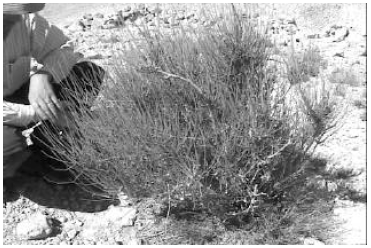
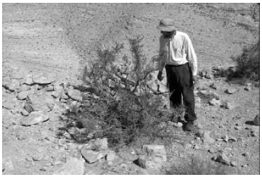
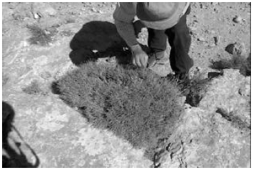
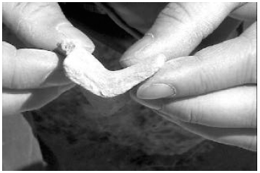
I was also curious to view the various sorts of bushes that grew on Sinai, because of the well-known Biblical account of the bush that burned when God first revealed Himself to Moses at Sinai.[5] We found three different types of bushes in the bamah (Figures 28–30). These were typical of the bushes in the region.
 |
 |
 |
We had accomplished our major objectives at the bamah by 9:30 a.m. We needed to be back to our room before noon to check out. We would be driving to Jerusalem that afternoon to participate in the week-long 17th International Radiocarbon Conference.[6] We planned to return to Yeroham for a few more days following the conference.
 |
 |
 |
It was hot beneath the glaring desert sun by the time we had finished our work at the bamah, with no hope of shade on the top of the hill and precious little breeze. We were pleased at having accomplished so much so quickly, and considered consolidating our gains and heading back out then and there. But we still had water in our water containers, and the Midianite/Kenite settlement was only one hill away. Ultimately we decided to have a brief look around there while we had the chance.
 |
 |
 |
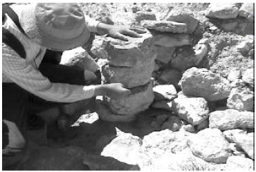
It was easy to get to the Midianite/Kenite settlement from the bamah. We followed the broadly rounded ridge which led west from the bamah (Figure 1). Once we had gotten beyond the upper end of the ravine which separates the bamah hill from the Midianite/Kenite settlement hill we turned north and then northeast, following the ridge line to the settlement.
A nice breeze had sprung up by the time we reached the Midianite/Kenite settlement. We admired their choice of settlement site in several ways. It was on top of a hill—a steep-sided ravine dropped away to the northeast—obviously easily defended. The view was grand in nearly all directions. And the site was well up above the plain, making best use of available breezes, as well as taking advantage of the natural cooling which comes with elevation. The only ones we pitied were those whose job it had been to make the trek up this steep hill with full water jugs each day.
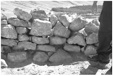
We were in among the remains of the Midianite/Kenite dwellings by 10:05 a.m. These were built of large stones, laid close together without mortar. Some of the stones were small boulders, causing us to wonder how they had been moved into place. The dwellings were built close together, in no particular pattern, often sharing adjoining walls.
 |
 |
 |
 |
 |
 |
We headed back out toward our car just before 11:00 a.m. We would be late checking out of our room—which did, in fact, catch us a scolding. We had meant to leave earlier, but time devalues when you poke about in four thousand five hundred year old dwellings where men and women once worked and children played—especially when you know from the Bible who those men and women were and why they settled there on that hill for a time.
Our water was gone before we were halfway back. And the car was an oven more fierce than the desert by the time we reached it. But our spirits were high as we drove the thirty minutes back to Ben Gurion University of the Negev. The weeks of planning, the large expense, the canceled flights, the lost sleep, the missed meals, the time away from our families, had all been worth it. We had accomplished more in a single morning than we had dared hope we might accomplish in a week. We had walked where Moses had walked. We had climbed the hill he had climbed beneath the burning desert sun. We had been the first in many, many centuries to set knowledgeable eyes on the bamah where he had constructed an altar four and a half thousand years ago. We had visited where his Midianite/Kenite relatives had lived during the Israelites' yearlong stay at Sinai. And all of this we had captured on digital video, documenting the present state of the sight and enabling us to share what we had learned and experienced with others.
Our work at Yeroham was not yet complete, of course. We had yet to ascend to the summit of the mountain, to learn what the area looked like where God had descended in fire.[7] And we had yet to explore the plain where the Israelites had camped. But we would soon be back, to experience, learn, and document more. ◇
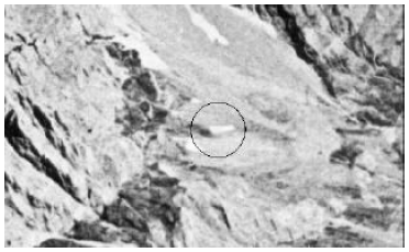
Earlier this year we placed an order for two commercial satellite photos of the southeast side of Mt. Cilo, where IO3 was photographed in the 1960's (Figure 43).[8] These were to be taken at different angles and at different times, late in the summer to minimize snow cover.
 |
The images would be in digital format (11-bit GeoTiff) on a CD. They could only be viewed via computer.
Unfortunately, the 11-bit GeoTiff format is not recognized by most mass-market programs designed to view and manipulate digital images. Many days were spent in preparation for receipt of our first 11-bit GeoTiff image, to guarantee that we would be able to get the image off the CD and onto the computer where we could look at it. This included obtaining a sample 11-bit GeoTiff image (a portion of which was shown last issue) to test our image-reading software.
I received the CD containing our first modern digital image of Mount Cilo on September 19. Despite our careful preparations this produced only error messages when we tried to read it from the CD into the computer.
Fortunately my eldest (college-age) son, Mark, was available to help. He is an accomplished C++ programmer. He spent some hours doctoring the software. Later that evening I had a hardcopy of our first modern image of Cilo in my hands.
It was immediately clear that we had a cloud-free image of the area, the focus was good, and illumination was excellent. There appeared to be more snow everywhere than we would like. Beyond that many more hours were required to figure out where IO3 should be—the image was taken from a very different perspective than previously. The plan was to zoom in (digitally) on the part of the image where IO3 should be, to see what, if anything, was there.
As it turned out the place where IO3 should be was out of view behind the mountain. The ground coordinates of the photo were those we had specified, but the satellite had taken the shot from north of Mount Cilo. This gave us a spectacular view of the whole north side of the mountain, but meant that the southeast side, where IO3 is situated in earlier (1960's) photos, was out of sight behind the mountain.
We are presently attempting to exchange this photo for one taken when the satellite was more to the south in hopes of learning more about the nature and location of IO3 at the present time. We are also expecting to receive another satellite image, from our second order, sometime in the next few weeks.
It has been clear from the beginning that the most direct way to determine whether IO3 is the ark is to hike into the area, climb Mount Cilo, and take a look.
While this is the most direct approach, it is not the easiest, most economical, or safest one. The area is a remote one in Turkey. The mountains are high and jagged with scree-covered slopes to the south. Because of the altitude the region is under snow much of the year. There are several permanent glaciers in the area on the north side of the mountain range.
Despite these difficulties Mr. Tom Godfrey, one member of the ark project team with previous climbing experience, determined to attempt a solo hike into IO3 this summer. Following months of preparation, Tom flew to Turkey in September. He was turned back by local authorities, however, and not allowed to climb, despite the fact that he had obtained permission to climb in Turkey before leaving the U.S.
Local inhabitants report danger due to wolves and bears in the mountains. The political situation is not good in the region, with tensions between the Turks and the Kurds. And one local resident reported danger due to land mines on trails in the mountains.
Tom's experience underscores the importance of the modern satellite photos. ◇
The Biblical Chronologist is a bimonthly subscription newsletter about Biblical chronology. It is written and edited by Gerald E. Aardsma, a Ph.D. scientist (nuclear physics) with special background in radioisotopic dating methods such as radiocarbon. The Biblical Chronologist has a threefold purpose: to encourage, enrich, and strengthen the faith of conservative Christians through instruction in Biblical chronology, to foster informed, up-to-date, scholarly research in this vital field within the conservative Christian community, and to communicate current developments and discoveries in Biblical chronology in an easily understood manner. An introductory packet containing three sample issues and a subscription order form is available for $9.95 US regardless of destination address. Send check or money order in US funds and request the "Intro Pack." The Biblical Chronologist (ISSN 1081-762X) is published six times a year by Aardsma Research & Publishing, 412 N Mulberry, Loda, IL 60948-9651. Copyright © 2000 by Aardsma Research & Publishing. Photocopying or reproduction strictly prohibited without written permission from the publisher.
|
^ Gerald E. Aardsma, "Biblical Chronology 101," The Biblical Chronologist 2.2 (March/April 1996): 9–12.
^ Moshe Kochavi and Rudolf Cohen, "Mount Yeroham," The New Encyclopedia of Archaeological Excavations in the Holy Land, vol. 4, ed. Ephraim Stern (New York: Simon & Schuster, 1993), 1506–1507.
^ Exodus 32:19.
^ Exodus 31:18.
^ Exodus 3:1–6.
^ The talk I presented at the conference was transcribed last issue in the "Biblical Chronology 101" column.
^ Exodus 19:18.
^ See Gerald E. Aardsma, "Research in Progress," The Biblical Chronologist 5.3 (May/June 1999): 7–16 for background on this research project.