| |
| Volume 7, Number 1 | January/February 2001 |
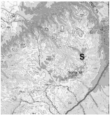
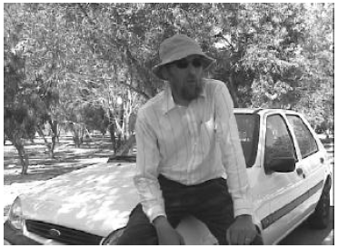
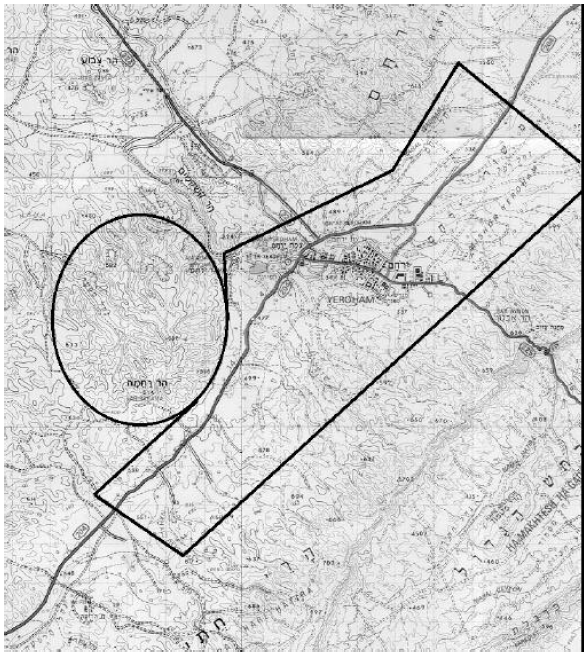
This is the final part of my report on the excursion Philip Gioja (as cameraman) and I took to Yeroham/Sinai this past June. The previous two parts can be found in the previous two issues of The Biblical Chronologist. In the first part of the report I shared results from my investigation of the bamah (high place) built by Moses at the foot of the mountain four and a half thousand years ago,[1] and my visit to the archaeological remains of stone dwellings built by Moses' Midianite in-laws on another hill at the foot of Mount Yeroham.[2] Last issue I reported on our ascent to the summit of Yeroham and on the early stages of our investigation of the crater of whose rim the summit is a part (Figure 1).[3]
 |
The present article picks up the narrative as we are descending the crater wall to the wadi bed on the floor of the crater. Our purpose is to discover if this crater is due to volcanism or is merely an erosional feature. The events described took place on Saturday, June 24, 2000.
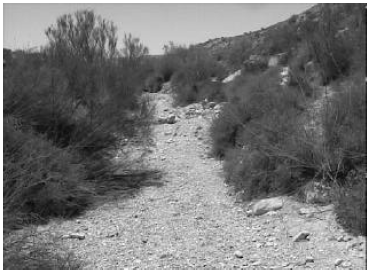
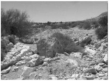
We reached the dry wadi bed at the floor of the crater around 11:35 a.m. (Figure 2). There was little breeze inside the crater, and with the sun almost directly overhead it was uncomfortably warm.
 |
 |
 |
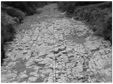
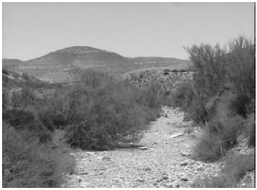
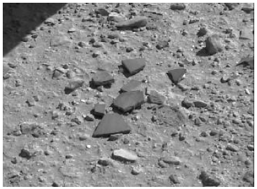
We began to follow the wadi upward, which took us in an overall southerly direction. We were keeping an eye out for any rocks in the wadi gravels which might have been of volcanic origin. After ten minutes of walking along the wadi bed it was clear that if there were any rocks of volcanic origin in that bed, they were extremely rare. All we had encountered were abundant limestone rocks and gravel (Figure 4).
 |
 |
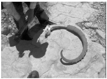
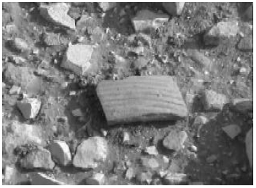
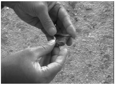
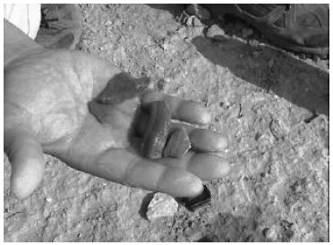
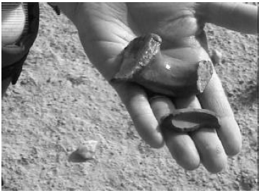
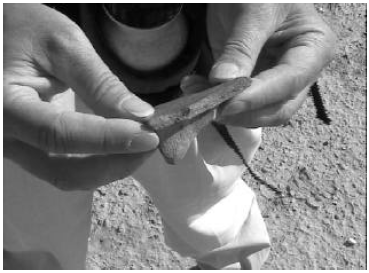
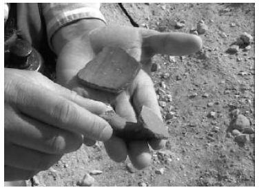
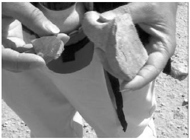
Shortly before noon we came upon the fine ram's horn specimen shown in Figure 7. By that time our water was warm, and so were we.
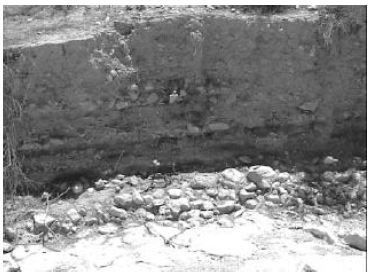
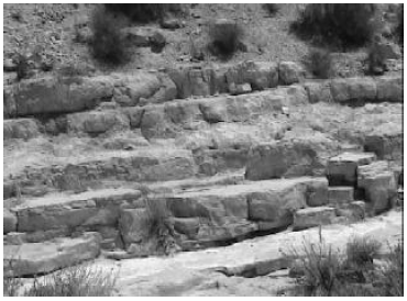
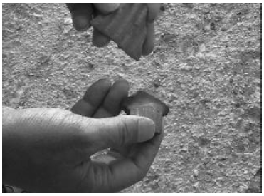
I am afraid we didn't find much else of interest in the wadi bed. We could find no trace of basalt or other volcanic rock anywhere in the wadi bed that hot afternoon. I have included lots of pictures of the sorts of rocks and stratigraphy we did find. These are not of much interest to a general audience, but they are likely to be important to individuals with geological background. As best I can tell—not being a geologist—they all seem to argue against the volcanic theory of origin of this crater. The rock strata we encountered were all clearly limestone, and hence of sedimentary origin. Bedding plains were generally horizontal, with a slight tilt upwards to the south. Everything we saw in the crater seemed to us to say that it had been created by erosion, not volcanism.
 |
 |
 |
 |
 |
 |
 |
 |
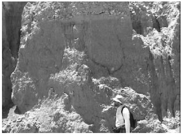
At one point we came upon a large section of limestone with copious embedded chert nodules (Figure 13). These occurred in at least two different strata, separated horizontally by six feet or more. I felt this would have been a rich find for anyone wishing to manufacture flint tools, and wondered whether this was the ultimate source of the chert flakes we had found in such abundance near the summit earlier in the day.
 |
 |
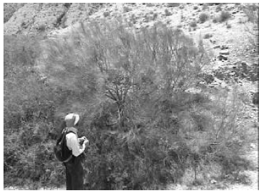
We encountered an occasional bit of green biology, which lent relief to the otherwise overwhelming white limestone geology of the crater floor. Figure 14 shows a lovely light-green bush we came upon at a turn in the wadi bed. This bush had long, thin, pliable, needle-like leaves, which gave off no perceptible odor when crushed. I think this was the largest native plant we encountered anywhere on Sinai.
 |
 |
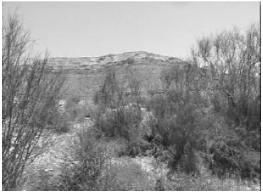
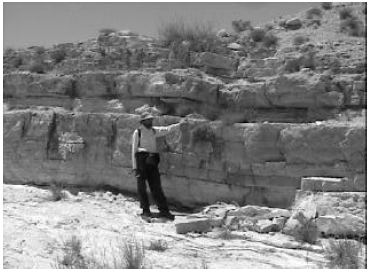
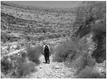
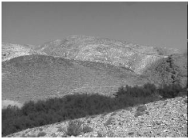
The wadi bed developed sharp turns and steep walls on either side as we neared the base of the south rim of the crater (Figure 15). By 12:55 p.m. half of our water supply was gone and we were on our way up and out (Figure 16). My heart was soon pounding in my chest, despite frequent stops for rest. There was no shade to offer any relief from the sun. The weak breezes which stirred from time to time provided no relief from the oppressive, mid-day heat. We soon were hoping that each rise before us would be the top, but we were disappointed more than once.
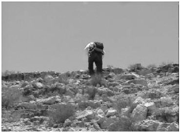
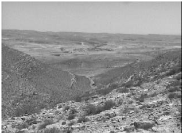
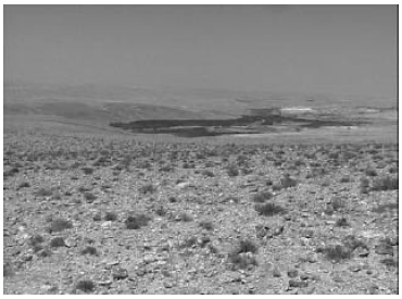
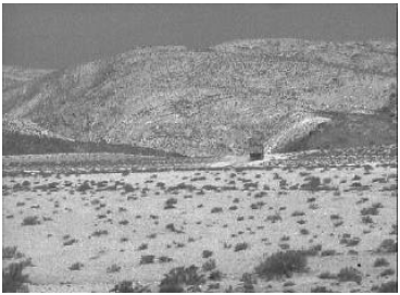
We crested the final rise at 1:34 p.m. and were rewarded with a fine view spread out far below in front of us (Figure 17). Unfortunately, this view was not the one we had expected. We were, in fact, looking out over a military base, situated some miles southwest of the town of Yeroham. We had been led by the wadi bed more to the southwest than we had expected. We would need to follow the rim around to the east, and then north, back to the summit—a trek of a mile or more—before we could begin our descent.
 |
 |
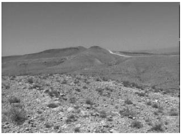
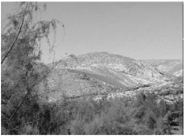
There was a welcome breeze up on the top. There was also a bulldozed military road, which made the trek around this part of the rim to the summit relatively smooth and straightforward. We were feeling pretty worn out by this point in the day, but we welcomed the opportunity to view another part of the rim close up, and to view the summit from another angle (Figure 18).
Another few minutes of walking brought us in view of the distant town of Yeroham, the reservoir, and the plain in which the Israelites had pitched their tents (Figure 21).
 |
 |
 |
Unfortunately, we took the wrong arm of the mountain down from the summit—an all-to-easy mistake to make, I realized in hindsight. This ultimately brought us to the west of the bamah and Midianite settlement hills. By the time we discovered this error we were much too far down the mountain and much too worn out to contemplate the hike back up the mountain we would need to make if we were to go back and make the correct turn.
Separating us from the bamah and Midianite settlement hills—and the path out to our car—was a very steep, deep ravine. We descended into the ravine, with the idea of following it out to its exit, which we knew must be somewhere below the dam. But we had to abandon that plan after some minutes of walking along the bottom of the ravine when we came to a sheer cliff drop-off in the wadi bed in front of us. The rugged beauty and uniqueness of the spot would have been captivating in ordinary circumstances—what a lovely desert waterfall there must be there when it rains. Unfortunately, we were not in ordinary circumstances and we were in no condition to appreciate much of anything, other than a long, cold drink and a place to rest in the shade.
It was hot, without a breeze, in the bottom of the ravine. Our (now hot) water was nearly spent. Our strength was spent. And it was now clear that the way out entailed a grueling climb up the other side of the ravine. Should we rest—and bake—in the bottom of the ravine, putting further strain on our dwindling water, or attempt the climb out immediately and risk physical collapse from heat and over-exertion? I decided on the later course of action.
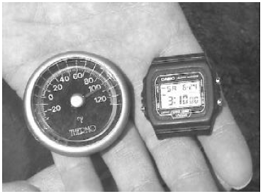
It was after 3:00 p.m. by the time we had topped the ravine. My pocket thermometer was reading 105°F by that time (Figure 22). We were looking forward to getting back to our air conditioned car.
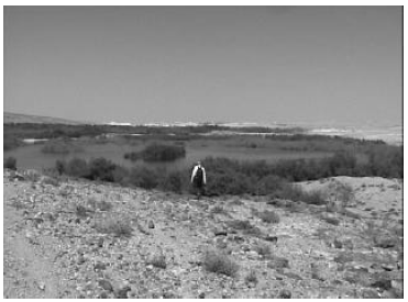
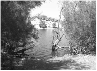
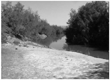
The reservoir was a very welcome sight (Figure 23). We made our way down to it and collapsed in the thin shade of the trees which grew at its edge (Figure 24). It was cooler by the water—though still hot. A gentle breeze kept the air in motion under the trees. We felt an obvious urge to drink the reservoir water, and to go for a plunge, just to cool off a bit. But we had seen—and smelled—sewage water from the town of Yeroham emptying back into the reservoir on our initial exploration of the abandoned park surrounding the reservoir a week previously, so we put these temptations from our minds.
We divvied up the last of our water—we would obviously be thirsty before we got back to our lodging at the Ben Gurien University of the Negev. We rested until we felt we had regained sufficient energy to make the final hike out through the park. We arrived back at our car at 4:15 p.m., nearly eleven hours after we had parked it that morning (Figure 25).
Our water was gone and we were thoroughly exhausted. But we were pleased at all that had been accomplished once again. We had completed our mission of scouting out the summit and crater of Mt. Sinai. We had learned that the summit had been used and significantly disturbed by the Israeli military for training purposes, so that there is no longer any hope of seeing it as Moses left it four and a half thousand years ago. We had also learned that if the crater behind Mt. Yeroham is of volcanic origin, it is doing a very good job of concealing that fact, to amateur eyes at least. We had uncovered not so much as a single pebble of volcanic origin inside the crater. The only evidence which did not immediately speak of sedimentation and weathering as the forces which had shaped Yeroham was the curious veneer covering many of the limestone rocks just north of the summit. As this veneer was found in the widened cracks between lumps of limestone, its origin seems necessarily to date long after these rocks had been formed—indeed, after they had experienced exposure and weathering at the surface. My impression that day was the same as it is now, that the notion of a "fountain" spewing molten rock into the air from just inside the crater rim and very near the summit seemed best able to explain the distribution of the veneer. But our brief survey of the area was not adequate to reach any firm conclusion in this regard, or even to feel very confident of this impression we had come away from the summit with.
 |
 |
We took the next day, Sunday, June 25, off. We were too fatigued to contemplate any further exploration. That made Monday, June 26, our last working day.
We rose before 6:00 a.m. and had a light breakfast of granola bars and dry bread. Our principal objective was to survey a portion of the plain on which the Israelites had camped. Archaeologist Thomas L. Thompson had reported finding pottery shards covering an area of more than a thousand acres on this plain.[4] Abundant pottery is a necessary condition for any plain which had been camped on for a year by two million people four and a half thousand years ago. We wanted to get a first-hand impression of the density of pottery shards, and, as with all this venture, we wanted to capture our experience on digital video so others could share in our experience without having to travel to Yeroham to do so.
 |
 |
The plain itself is very large—roughly 3,000 acres (Figure 26). We did not attempt to survey all of this area. In hindsight I wish we had surveyed more of it. The spatial distribution of the pottery defines the location and extent of the Israelites' tent city while they stayed at Sinai. It would have been nice to delineate the boundaries of the Israelites' tent city. Another time, perhaps.
We restricted our survey to the corner of the plain which butts up against the east side of Sinai (Figure 27). The area of this section, between the mountain and the modern road, route 204, is maybe 30 acres.
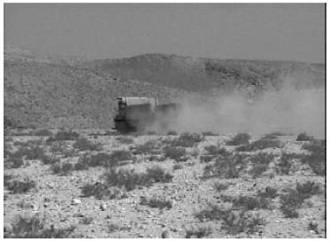
We were somewhat dismayed, as we walked out across the abandoned park to this section of the plain, to see extensive construction of water works for the town of Yeroham underway. Huge dump trucks and backhoes were making a thunderous racket as they unwittingly obliterated acres of evidence left by those earliest Israelites four and a half thousand years previously.
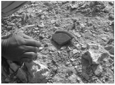
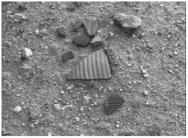
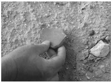
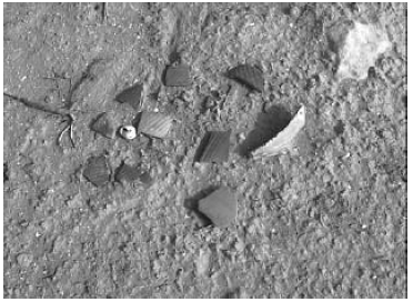
But as soon as we had moved into an undisturbed section of the plain we encountered pottery shards everywhere. The ground at our feet was littered with pottery shards, at least one shard every couple of feet. One would have been hard pressed to find a ten foot square section that didn't have a pottery shard in it.
We were impressed by the good view of the bamah which was available everywhere we walked. Moses had obviously chosen a good spot to carry out the public ceremony confirming the covenant between God and the Israelite nation (Exodus 24:4–8).
 |
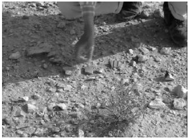 |
We made two lengthy transects in different directions across the area of interest to our survey. We walked along with several yards between us. Each time we spied a pottery shard we would call out "piece". This gave us an impression of the density of pottery over a roughly twenty foot wide path as we walked along. There were few intervals of silence.
 |
 |
 |
We did encounter a few places where pottery was rare, but most of these were readily explained—an area which was washed by a small wadi, an area covered by fresh-looking dunes, a rock-strewn slope which wouldn't have made much of a place to pitch a tent because of the grade. But these bare spots were the exceptions; the rule was pottery shards everywhere.
We crossed the large wadi at the foot of Sinai and surveyed the ground for pottery shards at its base. We found very few shards in this region, suggesting that the wadi had acted as a natural boundary to the Israelite tent city.
 |
 |
 |
 |
 |
 |
 |
 |
 |
 |
 |
We completed our planned survey somewhat before noon. We were standing at the foot of the bamah hill once again, but the sound of military helicopters and frequent booming percussions in behind the mountain discouraged any thought of one last climb to the bamah or the Midianite village. We were glad we had finished our survey of the summit and the crater before the military training exercise which was now obviously in full swing had begun.
 |
 |
 |
 |
 |
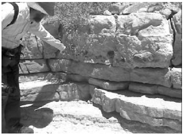
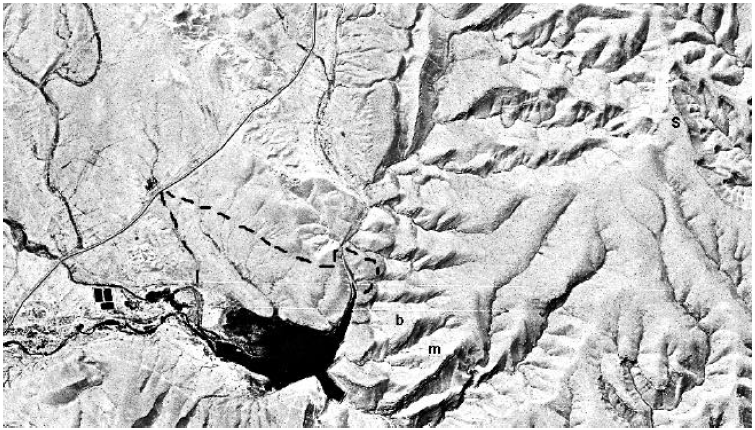
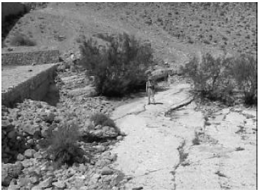
We decided to take the path behind the dam on our way back out of the park to our car. I wanted to get some pictures showing how the limestone strata tilt up toward the north in the wadi bed below the dam (Figure 46). With so little effort needed to erect man-made dams above these natural bedrock outcrops, and materials to do so readily at hand, it seems probable that primitive dams, increasing the volume of water impounded, existed at this spot from the earliest human presence in the area. But even without man-made dams there would have been one or more natural pools of water at Sinai when the Israelites visited there because the unusual northward tilt of these limestone strata causes them to act as natural dams.
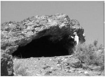
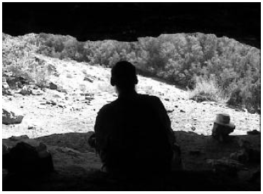
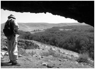
On our way to the dam we came upon another cave (Figures 47,48 and 49), which had seen much use over the years judging from the thick soot on its ceiling. We thought again of Elijah's stay in a cave at this mountain as we explored this cave.[5]
 |
 |
Having fulfilled our objective at the dam we made our way back out to our car, using the now familiar gravel road which provides service access to the dam.
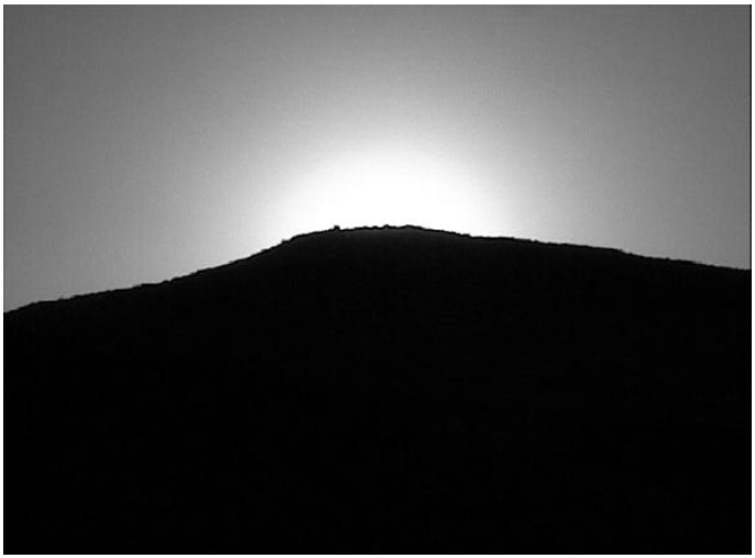
We spent our final evening on the plain at the foot of Sinai, capturing photos of the bamah with the setting sun in behind it. We were too worn out from lack of sleep, lack of food, and having climbed this Negev mountain beneath the desert sun a few too many times to take on anything more ambitious.
 |
 |
 |
When we had the shots we wanted we turned and trudged back toward our car—one last hike across the plain where, four and a half thousand years previously, a host of newly liberated slaves had camped, and their children had played. The monstrous yellow-green dump trucks had been busy all day, hauling sewage from the channel and dumping it in the slight depression up close to the mountain. The air smelled like an open septic system. The giant wheels of the trucks had thrown up clouds of dust, which now lay four or five inches deep on either side of the dirt road they had scarred across the plain. Each new footfall in this piled up dust sent it back up into the desert air, our noses, and our throats. Infrequent, distant percussions kept us mindful that military training was in full swing not too many miles away, in behind the mountain.
I felt a frustrating sense of loss as I walked away from the mountain that last time. This site which had been remarkably preserved for four and a half thousand years was, because of ignorance of its true significance, rapidly vanishing before our very eyes. Would there be anything left of the archaeological evidence at Sinai for my grandchildren to see, I wondered.
It is the six month anniversary of my climb to the summit of Sinai as I type the closing paragraphs of this report. The Illinois prairie outside my office window is a chill winter scene of clear blue sky and sparkling snow-blanketed ground. The heat and thirst of Sinai seem far away.
As I think back over our experience at Sinai I recall several first-hand impressions. Perhaps the strongest was of the emptiness which is there today. The teeming vibrancy which fills the pages of the Biblical narrative of the Israelites' stay at Sinai is absent at Yeroham today. The thousands of tents were folded and moved on to the wilderness of Paran long ago. The Midianites went with them. Moses and Joshua went too. And the supernatural manifestations of the presence of God also moved on, going before them, leading the way. What remains is another average Negev mountain, unimpressive to the senses.
The summit was deserted and quiet when we visited it. No trumpets split the silence. Nor was there any fire or thick cloud there—only clear sky and blazing desert sun.
It is all so empty now—the summit, the bamah, the Midianite village, the plain—a deserted relict of an ancient glorious past.
And yet Sinai came to life again at moments during the few brief days we spent there. As I peered over the steep side into the deep ravine to the north of the Midianite encampment, just ten or twelve feet from the nearest rock dwelling, I could easily imagine a Midianite child playing about my feet, and hear his mother chiding in an unfamiliar tongue from among the dwellings where she was busy preparing supper, "Don't play so close to the edge, dear".
And as we paused to assemble broken fragments of a pottery dish on the saddle between the bamah and the Midianite encampment, I pictured a young girl carrying this very dish, out gathering manna, accidentally tripping over a stone…
 |
And down on the plain, as I stooped to pick up yet another broken jar handle from the desert sand, I looked toward the reservoir and saw, fleetingly, a woman carrying the jar, full of water, and balanced with a gracile ease, almost as if by magic, upon her head…
And again, as I stood in the center of the ring of stones at the bamah and looked out toward the plain, I could see a large group of elders standing before me, within the stone wall of the bamah, filling the large flat area there. They were looking up in my direction, their faces framed by full gray beards, which solemnly wagged their assent as they said, "All that the Lord has spoken we will do…"
Perhaps if you had been there, you would have seen much else besides. Though they moved on from Sinai four and a half thousand years ago, much evidence of their long-ago presence yet remains. And the evidence is evocative of distant memories.
It has been good to reflect over our brief excursion to Sinai as I have labored to get it on paper for others to see and share in these past several months. In one sense I feel a deep satisfaction—so much learned, a job well done.
But the job is hardly complete, of course. There is so much more yet to understand. What is the source of the veneer on the rocks near the summit of Sinai? Can we determine how rapidly the limestone of the bamah has been eroding, to gain a better understanding of the cupmarks? Are the two archaeological layers at the Midianite settlement the result of the earthquake which accompanied God's descent on the mountain? Might we radiocarbon date these two layers to learn about this? Might we radiocarbon date the earliest layer to check our chronology of the Exodus? Might careful surface archaeology yet discover which tribes camped where? Might it discover where the original tabernacle was erected? And what is to be done to preserve the site long enough for an honest attempt to be made at answering such questions? What is to be done to preserve this ancient, holy site for future generations to experience?
Sinai: desert mountain; seat of revelation; birthplace of a nation; lost for millennia; found at last; revealer of long-held secrets; seat of mysteries; vanishing now. ◇
The Biblical Chronologist is a bimonthly subscription newsletter about Biblical chronology. It is written and edited by Gerald E. Aardsma, a Ph.D. scientist (nuclear physics) with special background in radioisotopic dating methods such as radiocarbon. The Biblical Chronologist has a threefold purpose: to encourage, enrich, and strengthen the faith of conservative Christians through instruction in Biblical chronology, to foster informed, up-to-date, scholarly research in this vital field within the conservative Christian community, and to communicate current developments and discoveries in Biblical chronology in an easily understood manner. An introductory packet containing three sample issues and a subscription order form is available for $9.95 US regardless of destination address. Send check or money order in US funds and request the "Intro Pack." The Biblical Chronologist (ISSN 1081-762X) is published six times a year by Aardsma Research & Publishing, 412 N Mulberry, Loda, IL 60948-9651. Copyright © 2001 by Aardsma Research & Publishing. Photocopying or reproduction strictly prohibited without written permission from the publisher.
|
^ Gerald E. Aardsma, "The Bamah of Moses at Mount Sinai" The Biblical Chronologist 6.3 (May/June 2000): 1–10.
^ Gerald E. Aardsma, "Report on the Excursion to Mt. Yeroham – Part I" The Biblical Chronologist 6.5 (September/October 2000): 1–13.
^ Gerald E. Aardsma, "Report on the Excursion to Mt. Yeroham – Part II" The Biblical Chronologist 6.6 (November/December 2000): 1–10.
^ Thomas L. Thompson, The Settlement of Sinai and the Negev in the Bronze Age (Wiesbaden: Dr. Ludwig Reichert Verlag, 1975), 21.
^ 1 Kings 19:1–13.